Showing posts with label Travel. Show all posts

How to Poop on a River Rafting Trip

You might remember that in August this year, I took my first river rafting trip with my boyfriend, Mike, and his family and friends.

[If you happened to miss the full Salmon River adventure, click here for the post!]


There was so much to learn about river life, and the burning question was, of course:
How the heck do you poop on a week-long, 80-mile rafting trip!

Well, I wouldn't recommend holding it. ;)

If you're an inexperienced rafter as I was, you might be envisioning a nice hole in the ground or a spot among some bushes. But the bathroom is not actually in the forest, in the ground, or God-forbid, on the river.

You've probably heard of the Leave No Trace hiking model. On the river, it's Pack In and Pack Out, and this applies not just to your garbage and supplies, but to your waste as well, which means you have to be creative about your bathroom breaks.

So how do you do it?

On our trip, we brought along a portable potty. Not the standing ones you see at concert venues and fairs, but a small plastic potty with a lid--think of a toddler training potty, but for adults. 

Every day you have to find a spot in the camp for the potty, private but accessible, and preferably with a nice view ;) The location is actually pretty important for women on the river. Here's why: Liquid waste, aka urine, needs to be kept separate from solid waste, so that the solid waste can be properly disposed of at the conclusion of the trip or at designated dumps stations along your journey. An ethical, environmentally responsible pee spot is in damp soil somewhere along the riverbed, not on dry ground. So it's convenient to set up the potty close to the river.

Our river group called our potty The Groover, and thankfully, there was a men's groover and women's groover. ;) The potty, before nifty plastic containers, used to be an ammo can! So when you sat on it, you'd walk away with lovely grooves in your bum! Hence, the name: The Groover.

Believe it or not, someone has to bear the responsibility of hauling The Groover on their raft day to day, campsite to campsite, and on our trip, that was all 80 miles! And toward the end of your trip, that potty gets pretty full! Mike and a river friend were our group's groover haulers. These guys, whoever they are in your rafting group are a hero of sorts--thank them, make them dinner or breakfast, and then crack some jokes. 

Eating River Dinner, telling stories and laughing.
The cool thing about living on a river is that poop becomes a group responsibility and effort, and takes on a larger meaning when you have to be conscious of how you go--you can't just dump, flush, and forget about it!

We had so much fun having conversations about poop--the best food to eat to help you poop, memories of the best on-the-river pooping spots--telling pooping-on-the-river stories, and yelling out in the morning as we packed up camp to head out on the river again: 
"LAST CALL FOR THE GROOVER!" 


These are the things you don't think about when you set out on a wilderness adventure. They're not the moments or memories you have in your photo album (thank goodness) but they're also the ones that make the trip, keep you laughing, and teach you new things about the way we live in our world.

If you're thinking about making river rafting your next adventure, check out the other essentials I brought with me, here!


Gulf Coast Beaches | The Wander Chronicles


Houston can be pretty overwhelming--heck, any city can be overwhelming-- and my wander itch was getting stronger, so my friend Josie suggested that we take a mini road trip to find Gulf Coast beaches. It couldn't have been a better idea, especially since we actually couldn't find it for a better half of the afternoon, but, of course, like all wander chronicles, getting lost led us to other beautiful places! 

This is the second installment of The WANDER CHRONICLES, so if you missed the first, hunting for Mt. Bierstadt's trailhead in the snow, you can find it here!
Frozen Point Texas

Frozen Point, Gulf Coast, Texas


Our destination began as Frozen Point, a part of the Gulf coastline that, in 1895, was subjected to 20 inches of snow! Our October day was still in the 90s, so it was difficult to picture a blizzard in this subtropical climate, and maybe our reason for choosing this legendary coastal protrusion--a little heat relief, please? 

Turns out, Frozen Point is mainly private land, one of the original cattle-ranching operations in Chambers County, owned by patriarch James Jackson whose 6,000 cattle head were covered in the bizarre snowstorm of 1895. So, while you can drive down the mainly gravel road to Frozen Point, through acres of beautiful prairie and marshes, you can't actually access the Point itself.

Anahuac National Wildlife Refuge


So, Josie, Corey and I found ourselves at Anahuac National Wildlife Refuge, 34,000 acres of protected ancient marshland. After a picnic of sandwiches and beer, we took to exploring some of the trails. 
Karbach Brewing and Beer Houston Texas
Josie was smart and brought along some Houston craft beer: Karbach Sympathy for the Lager
These are short, meandering little excursions but bursting with incredible flora and fauna. If you're a birder, this is the place to be--the refuge is known for its population of rails, a species of marsh bird that's described as chicken-like. Marsh dinosaurs! 

Butterfly garden Anahuac National Wildlife Refuge Texas

I'd like to return during the winter season because I might catch the snow-geese phenomenon where flocks of up to 80,000 swoop down from the migratory paths to feed in the marshes.


The Willows at Anahuac National Wildlife Refuge

Okay, so after toodling around this refuge, we left in search of the ocean. Where's the beach? Where's the sand? Where's the water? we kept asking, and found ourselves driving a tad northeast to High Island. 

High Island | Gulf Coast Beaches 

High Island Texas

You won't believe this but High Island gets its name because it's literally the highest point, at just 32ft above sea level, on the entire Gulf Coast, all the way to the Yucatan! This is definitely a different kind of landmark than the Fourteeners I've experienced in Colorado. 

Gulf Coast Beaches

The island is home to only 450 residents--that's only 100 more people than my graduating high school class!--and is rumored to have been a partying spot for pirates in the early 1800s. Now, it's a less-traveled, serene spot for sea kayakers, fishermen, and beach loungers.

Seashell Collecting on High Island

People drove their vehicles right onto the beach, no parking lot necessary. We hunted for shells and got our feet wet, and hit refresh on our souls. 

Corey showing off her seashell collection, Josie, and I at the edge of Texas.


People's State Park | Barkhamsted Lighthouse Trail

This past weekend, I had the opportunity to travel back to my home state of Connecticut (for my best friend's wedding! #stillreeling), so of course, I had to make time to satiate my wander fix. Vermont, New Hampshire and Maine might hog all the attention when it comes to the New England countryside, but there are places to get (responsibly) lost in the little 'ole Constitution state too.
The leaves just starting to turn along the Farmington River.
The foliage is definitely a sight to see, but one of the best parts about the New England backcountry are the little things, which, like most, I took for granted as a resident of these green hills, but after spending the last few years in the larger-than-life Colorado mountains, I re-discovered them on my short visit: like the clonk of acorns dropping from the oak trees.
Mom said she was knocked on the head with a falling acorn. If it's not already a sign of good luck, now it is. ;) I slipped on this acorn pile, hidden on some fallen leaves. 
I get my adventurous spirit from my mama so the two of us ventured into Peoples State Park: forest land donated by the Daughters of the American Revolution, where 200 year-old pine groves grow, and the remains of the historic village, Barkhamsted Lighthouse, can be found. 
Northwestern Connecticut Hikes
Like many people, when we heard "lighthouse," we immediately thought "ocean," but you won't find the traditional sea-beacon here. Instead, the village's lights served as a nighttime directional for stagecoach traffic traveling to Hartford in the 19th century--hence the lighthouse analogy! 
Northwestern Connecticut
The forest map in my backpack, the tree trail-markers, and Beanie, our family dog, in the background. :) 
The village began as a settlement in the 1770s when Molly Barber, a young white woman, fell in love with James Chaugham, a Native American of the Narraganset tribe. They ran away to the woods of Northwestern Connecticut to escape her disapproving father. 

I know, I know, a real-life Disney Pocahontas romance! #heavybreathing 

They started the settlement, and the village became one of the country's first multi-cultural towns, a tucked-away haven for freed slaves, survivors of colonial conflicts, and Anglo-European pilgrims. Some of the remains of this village, which dissolved toward the late 1800s, still remain like the homes' cellar holes, the village's charcoal pit, and even the cemetery where the couple and their family have been buried. 
Connecticut Hiking
In terms of difficulty, these trails are comfortable and short. Perfect 2-mile segments, and the shaded woods keep you out of the Indian summer sun, so common during New England's September. At the crest of a hill, we were greeted by Grand Vista overlook, a beautiful scene of the Farmington River sparkling through the forest. 
Lighthouse Trail

Needless to say, my soul was happy wandering in my woods again. 

Here is me, the maker of adventure herself, and family pooch number two, Taylor. :) 

P.S. This little history lesson brought to you by Connecticut Curiosities: Quirky Characters, Roadside Oddities, and other Offbeat Stuff by Susan Campbell and Bill Heald. Go buy the book, e-book, or check it out at the local library for more cool #thingstodoinCT 

Backcountry and Books


Mt. Bierstadt, A Colorado 14er

Mt. Bierstadt, a 14,060-ft mountain, one of more than 50 of Colorado's peaks that surpass 14,000 feet in elevation, receives a lot of smack in reviews.

A tourist's hike. 
Too many people!
Soooo crowded.
Easiest 14er.

To say the least, many people are not too impressed with Mt. Bierstadt in comparison to other 14er experiences. One of the biggest complaints is that the trail is overpopulated, especially during the weekends of its peak season, and for those who seek quiet and solitude in nature, this hike, believe it or not, is a disappointment.
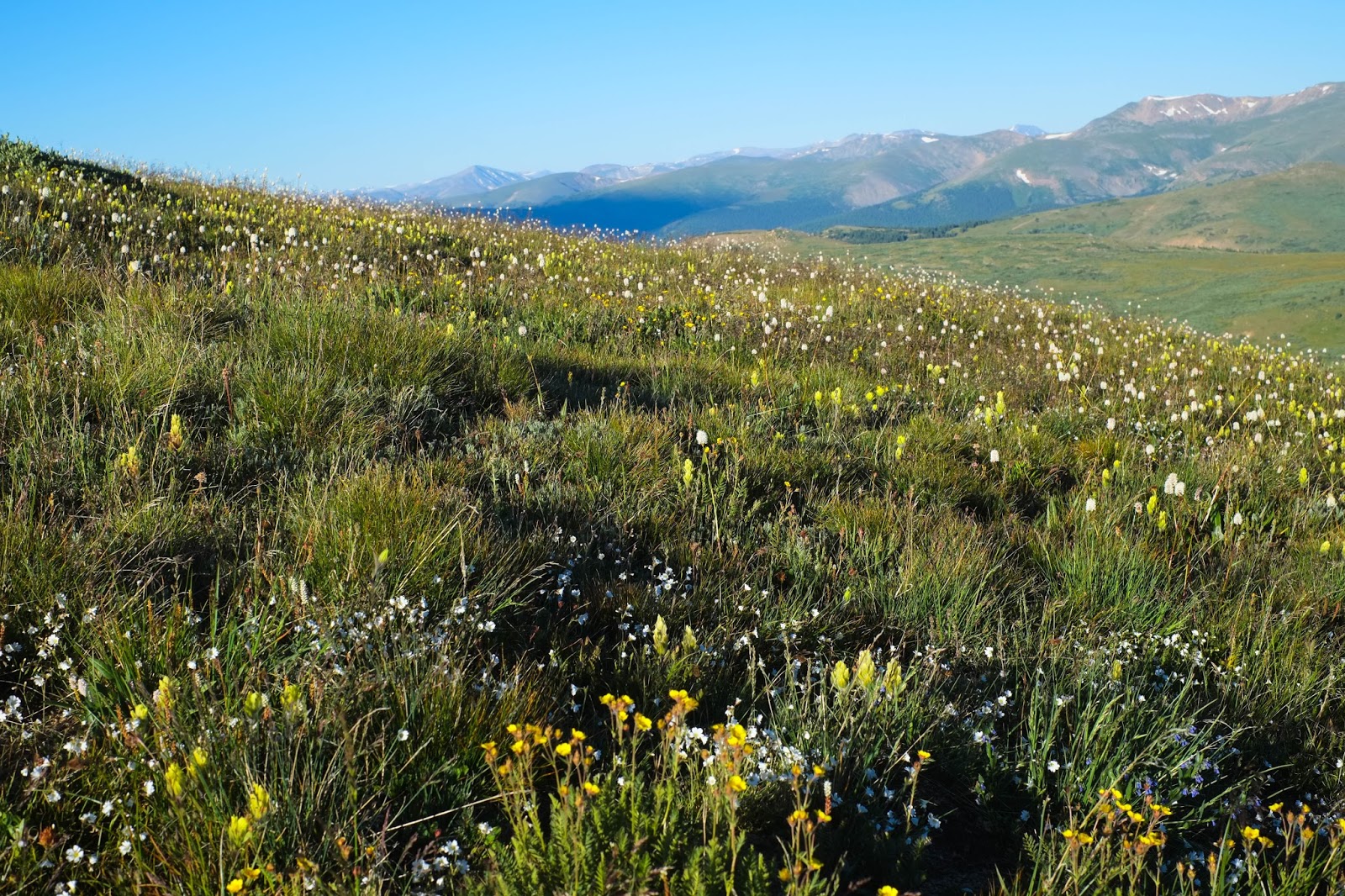
Fields of alpine meadow flowers beneath Sawtooth Ridge, the connection between Mt. Bierstadt and Mt. Evans' summits, two of Colorado's fourteeners.
Except, that almost everyone and anyone who attempts to summit a 14er is looking for exactly the same thing: a wilderness experience, a day that wrenches you from the ordinary, and challenges your body and your mind. So, in my opinion, it's unfair to punish the mountain for so many people who wish to experience it. Maybe as a native New Englander, I am more easily impressed, but this experience, to hike a 14er, let alone to summit it, is a privilege and an accomplishment, and deserves all of our appreciation and respect.
Recently, I had the incredible opportunity to summit the mountain with some of the best company. This was a unique experience because it was the first time that I hiked with a couple of talented artists. Daryl Love is a wonderful friend and photographer in Fort Collins, Colorado, and Alathea Cantrell is a painter and fiber artist at the Fort Collins Downtown Artery.
Photo by Daryl Love Photography

This was our first outdoor adventure as a trio though it felt like we had been on dozens together, and Alathea's first fourteener journey, despite growing up in Colorado!
The summit trail began right at the trailhead parking lot. For many high altitude hikes where the beginning of the trail is a bit of a hike in itself to find, this was an efficient and welcoming start when our journey began between four and six a.m., and followed a few hours' drive in the middle of the night. The sunrise was the first breathtaking moment on a hike that would literally take our breaths away.
After some switchback through the softest, greenest brush and blooming cacti, the landscape opened up to the alpine.
Photo by Daryl Love Photography
We made a lot of stops for photos, for snacks, for catching our breath, and for taking it all in.
Mt. Bierstadt receives an incredible amount of visitors a year, which has led to significant trail erosion. We didn't notice it much on our ascent, but coming down from the summit was especially difficult on the fine, steep, sandy slope. A group of trail workers, however, were working hard to repair and rebuild the trail during our visit, selecting large rocks for trail steps, fitting them to size and setting them in place. "Thanks for your work!" we said as we passed.
Photo by Daryl Love Photography
My favorite part of this trail was its fields of wildflowers.

After a steep, straight-up climb, we came to the final leg our journey: some boulder scrambling over and up to the summit.
Photo by Daryl Love Photography

Here we are! At the top!


I was pretty excited to have carried with me an art print to the summit by Fort Collins designer, Patrick Richardson, who creates these awesome topographical prints of Colorado's Fourteeners. (His tumblr The Woods are Wild features some of his illustrations and t-shirt designs.) I must have been a little woozy from the elevation because I completely forgot to take the print out of its protective sleeve for the picture!


Alathea and Daryl took naps at 14,060 feet.

This whole trip was a real accomplishment, because if you remember, Madison and I had attempted this mountain back in June, and we ended up wandering around in a snowstorm! Check out that Wander Chronicle, here!


River Rafting Essentials

I'm going on my first multi-day river rafting trip this weekend and I am so pumped. This trip has been on my bucket list since I was little when I flipped through National Geographic magazines in the dentist's waiting room, and I can't believe it's happening. On Sunday, Mike and his family and I are leaving for the main Salmon River in Idaho. Luckily, they are pros so I don't have to do anything other than come along for the ride (literally), but I was still clueless as to what to bring. A whole week on a raft means minimal packing and creative hygiene strategy. So, after much planning and some shopping, I developed a solid packing kit. Here's what I will be bringing on the Salmon!
river rafting gear

Pelican Small Storm Case

Used by the military, these waterproof, shockproof cases are excellent for storing expensive, fragile items like a DSLR camera, on a raft that will be jostled, bumped, and well, wet. They're lightweight, watertight, and guaranteed for life. Plus, they come in a thousand different sizes, styles, and are customizable too.  

Athleta Bathing Suit

Bikinis are no-go. You want something that will stay on, and let's be honest, still look kinda cute. 

Teva Churn Water Shoes

These water shoes have saved my life since I bought them and they'll be coming with me on the Salmon. Their fold-down Shoc pad heel allows you to wear them as slip-on clogs! This style isn't available anymore, but that's because Teva has improved on them with Churn Evo. 

PrAna Mindy Sun Hat

I actually picked up this sun baby in Moab, Utah when I was rock climbing and really needed more protection from the desert heat than just my sunglasses could provide. This straw hat is durable, stays put even when I ride my bike, and has a brim just large enough to shelter the tops of my shoulders. I love the beaded crown accent too. 

Chacos

Okay, everyone knows that you can't possibly go on a river trip, or be a Coloradoan, without a pair of Chacos. I love the purple ones pictured above, but I'm actually going to be wearing the same pair Mike wore when he was eight years old! 

Water Bottle

Common sense? Yes. But dehydration is probably the biggest danger on any lengthy outdoors trip. Stay hydrated! I like Nalgenes because I can cover them in stickers. :-P

Camera/GoPro

Of course, my Fujifilm X-Pro1 is coming with me! And, my GroPro. I have the Hero 3, but the 4 is now out my friends, and you'll want to get all of your adventure in first-person point-of-view style. 

Nuun Tablets

Electrolyte enhanced water tablets replenishes your body with energy after you've been sweating it out all day on the river. Did I say stay hydrated? You can get these pretty much anywhere btw (REI, Sierra Trading Post, Trader Joe's, Whole Foods, etc.)

EcoXGear Eco Extreme Speaker/iPhone Case

Can't float down a river without some tunes! This speaker is waterproof and impact-resistant protecting your iPhone, Android or Mp3 player with some extra room for cash. Best part? Don't worry about dropping it to the bottom of the river, because it freaking floats! 


Some other things I'm bringing, but aren't pictured are:


Bandana: One that provides UV protection, quick-dry technology, and is an insect repellant--hi yah!-- -because my curly hair is going to be knarly by the end of this week-long trip. 

Rain Jacket & Waterproof Pants (what?!): It's a river trip, you're gonna get wet, so why waterproof clothes, you ask? Because being wet on the river is cool, but when you camp for the night and it's raining, it's no bueno. These are just-in-case measures. Always be prepared friends!

Hammock or Sleeping Bag: This is your preference. Hammocks work well for river trips because they pack down to almost nothing, but I'll be bringing my super light sleeping bag, and throwing it down on the sand under the stars. No tent needed. :)


Here are a few other links (more guy-geared) to river rafting pack advice that I found helpful!

10 Things You Absolutely Should Pack for a River Trip from The Clymb
What Gear Should I Bring on My Multi-Day Rafting Trip? from Outside Magazine

Have you ever been on a rafting trip? What did you bring? Let me know in the comments. Hope you found this list helpful! :) Can't wait to share the adventure when I return! 

Take Your Breath Away: Hanging Lake, CO

I absolutely love hosting friends and family in Colorado. There's more to show them than time allows, and this visit from my best friend Aly was no exception. I sent Aly the link to "20 Colorado Places That Will Literally Take Your Breath Away" and told her to choose the places her wandering heart desired, and she chose Hanging Lake in Glenwood Springs, Colorado as one of our many destinations. 
If you aren't familiar, Hanging Lake is a natural geological phenomenon. For thousands of years, two waterfalls meet to form a rare, elevated lake, maintaining a stable ecological system and a lush, hanging plant garden--both fragile and in danger of "too much love."
That's right, we love this national natural landmark so much, we're smothering it. Although the National Park Service (NPS) has enforced a variety of etiquette guidelines (aka RULES) for experiencing this place (Basically, see with your eyes; not your hands, feet, or wading torso), enforcement is our responsibility as visitors. Cue "America the Beautiful" fanfare and feelings of pride and accountability, right?

Well, many people become a little over-excited, and neglect the countless signs that plead with visitors: "Please do not cut corners at switchbacks" and "No dipping body parts into the water or walking on fallen trees within the lake as contaminants from your body will impact the fragile ecosystem."
During our trip, one such visitor ventured out onto a fallen tree within the lake (the tree pictured, above, in the title photo). Of course, her friends (four or five of them) wanted to do it too (Monkey See, Monkey Do), until an entire group of young adults in a mere ten minutes had waded their bodies through this delicately balanced environment. You can imagine how hard it was to watch, especially since the National Parks Service says: "It is not only our responsibility to police our own actions and that of our families and friends, but also to gently remind other visitors that may not be aware of the rules and why they exist." 
Mikey decided it was important to gently remind these visitors of environmental respect and caution. Unfortunately, he put himself out on the line, and while many other bystanders supported him, the visitors who trespassed became upset. 

While I feel blessed to have experienced this place and didn't violate any of the rules, I still felt guilty, personally responsible, for my presence as a part of the crowds of people who, scrambling to see a piece of natural paradise, threatened to damage it for good. 

If you feel the need, donate or volunteer to the NPS to protect our natural landmarks, and when you visit, please, respect the landscape around you. 

Some believe it might be better to seal off these places to visitors in order to ensure their survival. What do you think? 


Hail the Voo: Climbing Vedauwoo


July 4, 2015

What better way to celebrate our country than to play in its natural beauty? 

The gang and I drove to Vedauwoo (pronounced Vee-dah-voo), Wyoming on Independence Day. As ever, I'm incredibly lucky because this "land of earthborn spirit" is only a glorious hour from Fort Collins, Colorado. What started as a temperate, holiday crag day though, flipped without warning to wild conditions...

Nick, packing up and heading out on the trail, tape-gloves ready.
We often choose to climb in the Reynolds Hill area because it's typically less crowded than Central, and one of the most scenic parts of the park. There are 33 routes in this area alone, and on the hike, we walked along wildflower meadows and aspen groves, and splashed through a refreshing brook or two.  
We found a giant mushroom brain on the path, which believe it or not, is totally edible and could've fed all six of us! (below)
Vedauwoo is the kingdom of crack climbing. Last year, as an inexperienced trad climber (naive and ignorant) I jumped on Maiden (5.6) and placed 3 out of 4 pieces of gear incorrectly. Translation: If I had fallen, I would've been up a creek, down 30 feet. [Do not attempt!] This year, I successfully, correctly, and safely lead Maiden, among a few others. It's so rewarding to return to a crag and crush. 
Here's Will sending Klink (5.10) without a peep. 
Some of my first times trad climbing was in Indian Creek in 2014 where I first met Stephen, one of the most supportive, encouraging, positive dudes I've ever met. If Steven says "You can totally do that," then I know I can do it! I was so happy to finally spend a day climbing with both him and his beautiful (inside and out) girlfriend, Joanna. "No way, I wear my fancy outdoor clothes when I go out on the town," she said. "For climbing, I throw on these Aeropostale jeans I've had since I was fourteen."

And then, out of nowhere, without warning:

Marble-sized hail fell from the sky. We scrambled to gather the gear and find shelter. Thunder rocked the sky, and the hail came down with the force of a thousand pellet guns. Luckily, a rock outcropping was close by and protected eleven climbers through the storm while we watched as an inch of ice coated the ground, and water crashed off the routes we had just been climbing. 

In the hurry to find shelter, I had left my Fujifilm X-Pro 1 exposed and unprotected in the wild weather. By some miracle though, once the storm passed as quickly as it came, I unzipped my soaking wet Ruggard Hunter 15 holster bag to discover that my camera was completely dry! If anyone is looking for truly rugged protection for your photo rig, go with this brand (not a plug, I'm just a truly grateful and satisfied customer!). 

We really experienced the unexpected beauty of our country on this climbing day. Hope everyone had a 4th of July that was just as adventurous! 


ELLIPSIS © - DESIGNED BY HERPARK
∧